|
A57 Road
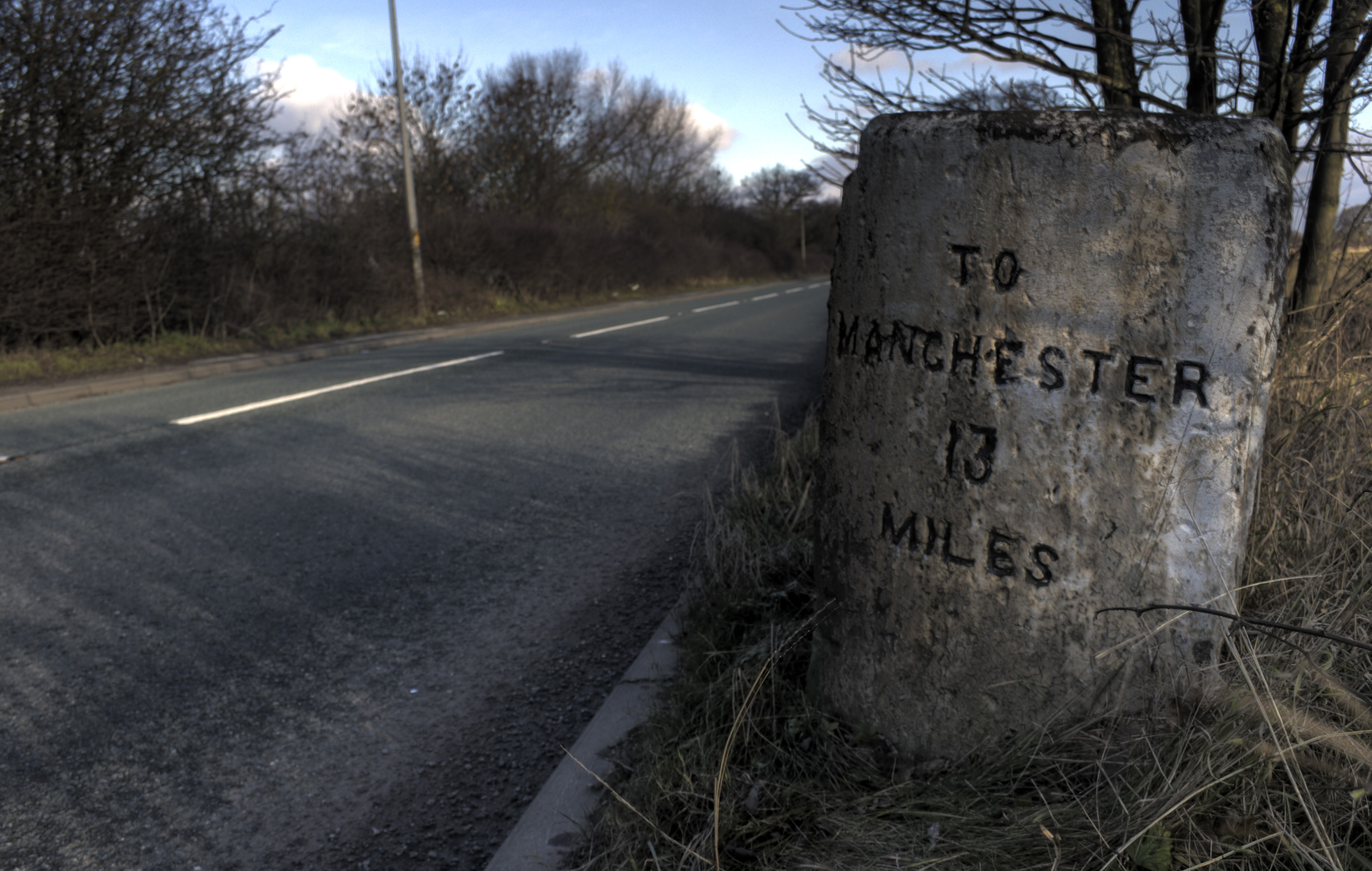
The A57 is a major road in England. It runs east from Liverpool to Lincoln via Warrington, Cadishead, Irlam, Patricroft, Eccles, Salford and Manchester, then through the Pennines over the Snake Pass (between the high moorlands of Bleaklow and Kinder Scout), around the Ladybower Reservoir, through Sheffield and past Worksop. Between Liverpool and Glossop, the road has largely been superseded by the M62, M602 and M67 motorways. Within Manchester a short stretch becomes the Mancunian Way, designated A57(M). Route Liverpool–Warrington The A57 begins at The Strand (A5036) near the River Mersey, as part of Water Street. It forms an east–west route through the north of the city centre with another one-way road system as Tithebarn Street (passing part of Liverpool John Moores University), Great Crosshall Street and Churchill Way in the east direction and Churchill Way and Dale Street in the west direction. The connecting roads Moorfields and Hatton Garden are also part o ... [...More Info...] [...Related Items...] OR: [Wikipedia] [Google] [Baidu] |
Salford
Salford () is a city and the largest settlement in the City of Salford metropolitan borough in Greater Manchester, England. In 2011, Salford had a population of 103,886. It is also the second and only other city in the metropolitan county after neighbouring Manchester. Salford is located in a meander of the River Irwell which forms part of its boundary with Manchester. The former County Borough of Salford, which also included Broughton, Pendleton and Kersal, was granted city status in 1926. In 1974 the wider Metropolitan Borough of the City of Salford was established with responsibility for a significantly larger region. Historically in Lancashire, Salford was the judicial seat of the ancient hundred of Salfordshire. It was granted a charter by Ranulf de Blondeville, 6th Earl of Chester, in about 1230, making Salford a free borough of greater cultural and commercial importance than its neighbour Manchester.. The Industrial Revolution of the late 18th and early 19th centuries ... [...More Info...] [...Related Items...] OR: [Wikipedia] [Google] [Baidu] |
Patricroft
Patricroft is a suburb near Eccles, Greater Manchester, England. History Patricroft may derive its name from 'Pear-tree croft', or more likely, 'Patrick's Croft'. In 1836, Scottish engineer James Nasmyth, in partnership with Holbrook Gaskell, built the Bridgewater Foundry in Patricroft. Nasmyth chose Patricroft, located on the west side of Manchester, ‘because of the benefit of breathing pure air, realising that a healthy workforce is a more efficient workforce'. He named the works "Bridgewater Foundry" in memory of Canal Duke, the first canal maker in Britain. Bridgewater Foundry was located adjacent to the Bridgewater Canal and the Manchester to Liverpool railway line. The foundry soon expanded to become a major supplier of steam locomotives. During the First World War, the factory's production was mainly diverted to munitions work. At the start of the Second World War it became a Royal Ordnance Factory, producing shells, tanks and guns. The engineering works closed in 1989: ... [...More Info...] [...Related Items...] OR: [Wikipedia] [Google] [Baidu] |
A59 Road
The A59 is a major road in England which is around long and runs from Wallasey, Merseyside to York, North Yorkshire. The alignment formed part of the Trunk Roads Act 1936, being then designated as the A59. It is a key route connecting Merseyside at the M53 motorway to Yorkshire, passing through three counties and connecting to various major motorways. The road is a combination of historical routes combined with contemporary roads and a mixture of dual and single carriageway. Sections of the A59 in Yorkshire closely follow the routes of Roman roads, some dating back to the Middle Ages as salt roads, whilst much of the A59 in Merseyside follows Victorian routes which are largely unchanged to the present day. Numerous bypasses have been constructed throughout the 20th century, one of the earliest being the Maghull bypass in the early 1930s, particularly where traffic through towns was congested. Portions of the route through Lancashire were proposed to be upgraded to motorway st ... [...More Info...] [...Related Items...] OR: [Wikipedia] [Google] [Baidu] |
Liverpool John Moores University
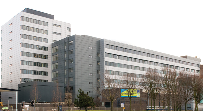
Liverpool John Moores University (abbreviated LJMU) is a public university, public research university in the city of Liverpool, England. The university can trace its origins to the Liverpool Mechanics' School of Arts, established in 1823. This later merged to become Liverpool Polytechnic. In 1992, following an Further and Higher Education Act 1992, Act of Parliament, the Liverpool Polytechnic became what is now Liverpool John Moores University. It is named after Sir John Moores, a local businessman and philanthropist, who donated to the university's precursor institutions. The university had students in , of which are undergraduate students and are postgraduate, making it the List of universities in the United Kingdom by enrollment, largest university in the UK by total student population. It is a member of the University Alliance, the NCUK, Northern Consortium and the European University Association. History Origins Founded as a small mechanics institution (Liverpool In ... [...More Info...] [...Related Items...] OR: [Wikipedia] [Google] [Baidu] |
River Mersey
The River Mersey () is in North West England. Its name derives from Old English and means "boundary river", possibly referring to its having been a border between the ancient kingdoms of Mercia and Northumbria. For centuries it has formed part of the boundary between the historic counties of Lancashire and Cheshire. The Mersey starts at the confluence of the River Tame and River Goyt in Stockport. It flows westwards through south Manchester, then into the Manchester Ship Canal at Irlam, becoming a part of the canal and maintaining its water levels. After it exits the canal, flowing towards Warrington where it widens. It then narrows as it passes between Runcorn and Widnes. From Runcorn the river widens into a large estuary, which is across at its widest point near Ellesmere Port. The course of the river then turns northwards as the estuary narrows between Liverpool and Birkenhead on the Wirral Peninsula to the west, and empties into Liverpool Bay. In total the ri ... [...More Info...] [...Related Items...] OR: [Wikipedia] [Google] [Baidu] |
Mancunian Way
The Mancunian Way is a two mile long grade separated elevated motorway in Manchester, England. It is officially made up of the A57(M) and A635(M) motorways, although the latter does not appear on road signs for practical reasons. It is also part of two other roads: the A57 to the west, which runs east–west through Greater Manchester linking the M602 and M67 motorways, and a short section of non-motorway A635 to the east. Part of this non-motorway section collapsed on 14 August 2015 due to a sinkhole. Route The road forms a major part of the Manchester-Salford Inner Ring Road and runs south of the city centre. Running eastbound, it starts as a two-lane dual carriageway and passes underneath the A56. Following this, the road widens to three lanes. At the next junction which leads to the A5103, the road reduces to two lanes and becomes an elevated highway. This section runs atop link roads and two roundabouts before reaching the next junction with the A34. At this ... [...More Info...] [...Related Items...] OR: [Wikipedia] [Google] [Baidu] |
M67 Motorway
The M67 is a urban motorway in Greater Manchester, England, which heads east from the M60 motorway passing through Denton and Hyde before ending near Mottram. The road was originally conceived as the first section of a trans- Pennine motorway between Manchester and Sheffield that would connect the A57(M) motorway with the M1 motorway; however, the motorway became the only part to be built. Numerous calls have been made to complete the motorway link between Manchester and Sheffield, the second and ninth most populous urban areas within the United Kingdom. Traffic between the cities is mainly divided between the Snake and Woodhead passes, which traverse the Peak District. Plans for a £180m improvement to the route by bypassing Mottram and Tintwistle, the A57/A628 Mottram in Longdendale, Hollingworth and Tintwistle Bypass, and the 'Glossop spur' linking to the A57 road are currently at the public inquiry stage but were 'suspended indefinitely' in January 2008. There are now ... [...More Info...] [...Related Items...] OR: [Wikipedia] [Google] [Baidu] |
M602 Motorway
The M602 motorway is a relatively short motorway, leading traffic into Salford, Greater Manchester, England, towards Manchester and by-passing the suburban town of Eccles. History The first section from Worsley to Eccles (now Junction 2) opened in 1971, and the second section from Eccles to Ordsall was completed in 1982. The motorway itself was originally intended to be a part of a bigger scheme, the South Lancashire Motorway. To be designated M52, the route would have linked Liverpool and Manchester, and would have been built to provide links to the growing UK motorway network. However, at the same time, the M62 was being extended north and east of Worsley, around the north of Manchester, and on to Yorkshire, to form part of the Trans-Pennine Motorway route. This would be an upgraded version of the original plan of the East Lancashire Road, the A580, but would link onto the existing route at Worsley. It was decided that the Trans-Pennine Motorway be extended to Liverpool to ... [...More Info...] [...Related Items...] OR: [Wikipedia] [Google] [Baidu] |
M62 Motorway
The M62 is a west–east trans-Pennine motorway in Northern England, connecting Liverpool and Hull via Manchester, Bradford, Leeds and Wakefield; of the route is shared with the M60 orbital motorway around Manchester. The road is part of the unsigned Euroroutes E20 ( Shannon to Saint Petersburg) and E22 (Holyhead to Ishim). The motorway, which was first proposed in the 1930s, and conceived as two separate routes, was opened in stages between 1971 and 1976, with construction beginning at Pole Moor near Huddersfield and finishing at that time in Tarbock on the outskirts of Liverpool. The motorway absorbed the northern end of the Stretford- Eccles bypass, which was built between 1957 and 1960. Adjusted for inflation to 2007, its construction cost approximately £765 million. The motorway has an average daily traffic flow of 144,000 vehicles in West Yorkshire, and has several sections prone to gridlock, in particular, between Leeds and Huddersfield and the M60 sectio ... [...More Info...] [...Related Items...] OR: [Wikipedia] [Google] [Baidu] |
Ladybower Reservoir
Ladybower Reservoir is a large Y-shaped, artificial reservoir, the lowest of three in the Upper Derwent Valley in Derbyshire, England. The River Ashop flows into the reservoir from the west; the River Derwent flows south, initially through Howden Reservoir, then Derwent Reservoir, and finally through Ladybower Reservoir. The reservoir is owned by Severn Trent. The area is now a tourist attraction, with the Fairholmes visitors' centre located at the northern tip of Ladybower. The east arm of the reservoir, fed by the Ladybower Brook, is overlooked by Hordron Edge stone circle. Design and construction Ladybower was built between 1935 and 1943 by the Derwent Valley Water Board to supplement the other two reservoirs in supplying the water needs of the East Midlands. It took a further two years to fill, which was done by 1945. The dam differs from the Howden Reservoir and Derwent Reservoir in that it is a clay-cored earth embankment and not a solid masonry dam. Below the dam is ... [...More Info...] [...Related Items...] OR: [Wikipedia] [Google] [Baidu] |
Kinder Scout
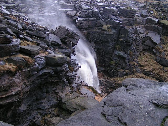
Kinder Scout is a moorland plateau and national nature reserve in the Dark Peak of the Derbyshire Peak District in England. Part of the moor, at above sea level, is the highest point in the Peak District, in Derbyshire and the East Midlands; this summit is sometimes simply called the Peak. In excellent weather conditions, the city of Manchester and the Greater Manchester conurbation can be seen from the western edges, as well as Winter Hill near Bolton and the mountains of Snowdonia in North Wales. To the north, across the Snake Pass, lie the high moors of Bleaklow and Black Hill, which are of similar elevation. Kinder Scout featured on the BBC television programme '' Seven Natural Wonders'' (2005) as one of the wonders of the Midlands; however, it is considered by many to be in Northern England, lying between the cities of Manchester and Sheffield. In chronostratigraphy, the British sub-stage of the Carboniferous period, the ''Kinderscoutian'', derives its name from K ... [...More Info...] [...Related Items...] OR: [Wikipedia] [Google] [Baidu] |
Bleaklow
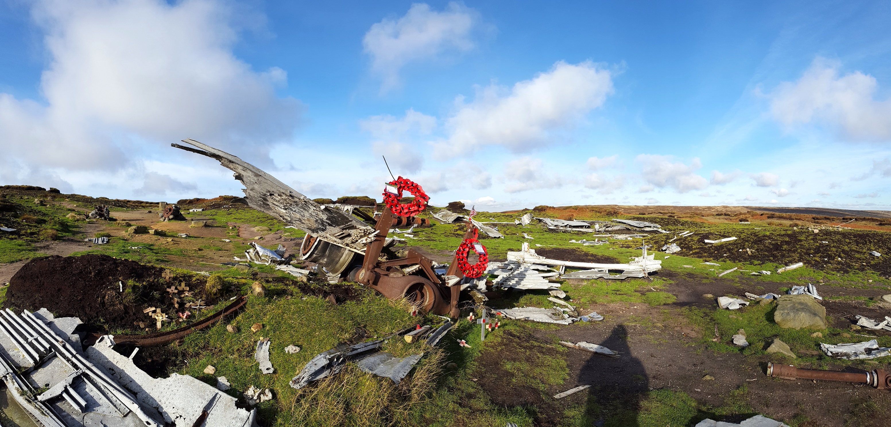
Bleaklow is a high, largely peat-covered, gritstone moorland in the Derbyshire High Peak near the town of Glossop. It is north of Kinder Scout, across the Snake Pass ( A57), and south of the A628 Woodhead Pass. Much of it is nearly 2,000 feet (610 m) above sea level and the shallow bowl of Swains Greave on its eastern side is the source of the River Derwent. Bleaklow Head (633 m), marked by a huge cairn of stones, the high point at the western side of the moor, is a Hewitt and is crossed by the Pennine Way. It is one of three summits on this plateau above 2,000 feet, the others being Bleaklow Stones, some 1.9 miles (3 km) to the east along an indefinite ridge, and Higher Shelf Stones, 0.9 miles (1.5 km) south of Bleaklow Head. At 633 metres (2,077 feet), Bleaklow is the second-highest point in Derbyshire and the area includes the most easterly point in the British Isles over 2,000 feet, near Bleaklow Stones. Description Muc ... [...More Info...] [...Related Items...] OR: [Wikipedia] [Google] [Baidu] |


