|
Ala-ud-Din Bahman Shah
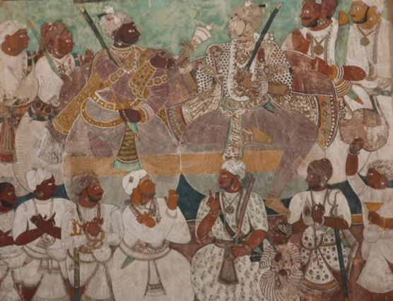
Ala-ud-Din Hasan Bahman Shah (; died 10 February 1358) whose original name was Zafar Khan or Hasan Gangu, was the founder of the Bahmani Sultanate. Ancestry and early life Hasan Gangu, the founder of the Bahmani Sultanate, was either of Afghans, Afghan or Turkic peoples, Turk origin. Encyclopedia Iranica states him to be a Greater Khorasan, Khorasani adventurer, who claimed descent from Bahram Gur. André Wink, Andre Wink, known for his studies on India, stated that he was an Afghan. According to the medieval historian Ferishta, his obscurity makes it difficult to track his origin, but he is nonetheless stated as of Afghan birth. Ferishta further writes, Zafar Khan had earlier been a servant of a Brahmin astrologer at Delhi named Gangu (ruler), Gangu (hence the name Hasan Gangu),Bhattacharya, Sachchidananada. ''A Dictionary of Indian History'' (Westport: Greenwood Press, 1972) p. 100 and says that he was from North India. Historians have not found any corroboration for the lege ... [...More Info...] [...Related Items...] OR: [Wikipedia] [Google] [Baidu] |
Bahmani Sultanate
The Bahmani Kingdom or the Bahmani Sultanate was a late medieval Persianate kingdom that ruled the Deccan plateau in India. The first independent Muslim sultanate of the Deccan, the Bahmani Kingdom came to power in 1347 during the rebellion of Ismail Mukh against Muhammad bin Tughlaq, the Sultan of Delhi. Ismail Mukh then abdicated in favour of Zafar Khan, who established the Bahmani Sultanate. The Bahmani Kingdom was perpetually at war with its neighbours, including its rival to the south, the Vijayanagara Empire, which outlasted the sultanate. The Mahmud Gawan Madrasa was created by Mahmud Gawan, the vizier regent who was prime minister of the sultanate from 1466 until his execution in 1481 during a conflict between the foreign (Afaqis) and local (Deccanis) nobility. Bidar Fort was built by Ahmad Shah I (), who relocated the capital to the city of Bidar. Ahmad Shah led campaigns against Vijayanagara and the sultanates of Malwa and Gujarat. His campaign against V ... [...More Info...] [...Related Items...] OR: [Wikipedia] [Google] [Baidu] |
Afghanistan
Afghanistan, officially the Islamic Emirate of Afghanistan, is a landlocked country located at the crossroads of Central Asia and South Asia. It is bordered by Pakistan to the Durand Line, east and south, Iran to the Afghanistan–Iran border, west, Turkmenistan to the Afghanistan–Turkmenistan border, northwest, Uzbekistan to the Afghanistan–Uzbekistan border, north, Tajikistan to the Afghanistan–Tajikistan border, northeast, and China to the Afghanistan–China border, northeast and east. Occupying of land, the country is predominantly mountainous with plains Afghan Turkestan, in the north and Sistan Basin, the southwest, which are separated by the Hindu Kush mountain range. Kabul is the country's capital and largest city. Demographics of Afghanistan, Afghanistan's population is estimated to be between 36 and 50 million. Ancient history of Afghanistan, Human habitation in Afghanistan dates to the Middle Paleolithic era. Popularly referred to as the graveyard of empire ... [...More Info...] [...Related Items...] OR: [Wikipedia] [Google] [Baidu] |
Kotgiri
Kotagiri is a village in Nizamabad district in the state of Telangana in India India, officially the Republic of India, is a country in South Asia. It is the List of countries and dependencies by area, seventh-largest country by area; the List of countries by population (United Nations), most populous country since .... one of the largest hanuman statue of Nizamabad is present here... it is an ancient village ruled by kakatiyas near to bodhan References Villages in Nizamabad district {{Nizamabad-geo-stub ... [...More Info...] [...Related Items...] OR: [Wikipedia] [Google] [Baidu] |
Deccan Plateau
The Deccan is a plateau extending over an area of and occupies the majority of the Indian peninsula. It stretches from the Satpura Range, Satpura and Vindhya Ranges in the north to the northern fringes of Tamil Nadu in the south. It is bound by the mountain ranges of the Western Ghats and the Eastern Ghats on the sides, which separate the region from the Western Coastal Plains, Western and Eastern Coastal Plains respectively. It covers most of the Indian States of Maharashtra, Karnataka, Telangana and Andhra Pradesh excluding the coastal regions, and minor portions of Tamil Nadu and Kerala. The plateau is marked by rocky terrain with an average elevation of about . It is subdivided into Maharashtra Plateau, Karnataka Plateau, and Rayalaseema & Telangana Plateau. The Deccan Traps in the north west were formed by multiple layers of igneous rocks laid down by basaltic lava flows following a massive volcanic eruption that occurred during the end of the Cretaceous period (66 Millio ... [...More Info...] [...Related Items...] OR: [Wikipedia] [Google] [Baidu] |
Gwalior
Gwalior (Hindi: , ) is a major city in the central Indian state of Madhya Pradesh; It is known as the Music City of India having oldest Gwalior gharana, musical gharana in existence. It is a major sports, cultural, industrial, and political centre in Madhya Pradesh. Gwalior is among the seven cities selected for new startup centres under India's growing innovation ecosystem. On World Cities Day (31 October 2023), UNESCO Director - General Audrey Azoulay announced Gwalior's inclusion among 55 new Creative Cities Network, world creative cities in the UCCN from India. This tag elevates Gwalior's identity internationally, spotlighting it's artists, music traditions and vibrant culture. It lies in northern part of Madhya Pradesh and is one of the National Capital Region (India)#Counter magnets, Counter-magnet cities. Located south of New Delhi, the capital city of India and from Bhopal, the state capital, Gwalior occupies a strategic location in the Gird, India, Gwalior Chambal re ... [...More Info...] [...Related Items...] OR: [Wikipedia] [Google] [Baidu] |
Gujarat
Gujarat () is a States of India, state along the Western India, western coast of India. Its coastline of about is the longest in the country, most of which lies on the Kathiawar peninsula. Gujarat is the List of states and union territories of India by area, fifth-largest Indian state by area, covering some ; and the List of states and union territories of India by population, ninth-most populous state, with a population of 60.4 million in 2011. It is bordered by Rajasthan to the northeast, Dadra and Nagar Haveli and Daman and Diu to the south, Maharashtra to the southeast, Madhya Pradesh to the east, and the Arabian Sea and the Pakistani province of Sindh to the west. Gujarat's capital city is Gandhinagar, while its largest city is Ahmedabad. The Gujarati people, Gujaratis are indigenous to the state and their language, Gujarati language, Gujarati, is the state's official language. The state List of Indus Valley civilisation sites#List of Indus Valley sites discovered, ... [...More Info...] [...Related Items...] OR: [Wikipedia] [Google] [Baidu] |
Malwa
Malwa () is a historical region, historical list of regions in India, region of west-central India occupying a plateau of volcanic origin. Geologically, the Malwa Plateau generally refers to the volcanic plateau, volcanic upland north of the Vindhya Range. Politically and administratively, it is also synonymous with the former state of Madhya Bharat which was later merged with Madhya Pradesh. At present the historical Malwa region includes districts of western Madhya Pradesh and parts of south-eastern Rajasthan. Sometimes the definition of Malwa is extended to include the Nimar region south of the Vindhya Range, Vindhyas. The Malwa region had been a separate political unit from the time of the ancient Malava Kingdom. It has been ruled by several kingdoms and dynasties, including the Avanti (India), Avanti Kingdom, The Maurya Empire, Mauryans, the Malavas, the Gupta Empire, Guptas, the Paramara dynasty, Paramaras, The Rajput, Rajputs, the Delhi Sultanate, the Malwa Sultanate, M ... [...More Info...] [...Related Items...] OR: [Wikipedia] [Google] [Baidu] |
Coromandel Coast
The Coromandel Coast is a coastal region along the southeastern front of the Indian peninsula. Its delimitations are numerous, but generally admitted to be bounded by the Krishna River, Krishna river River mouth, mouth to the north, the Bay of Bengal to the east, the Point Calimere Cape (geography), cape to the south, and the Eastern Ghats to the west. Some may definite its northern boundaries up to Ganjam. This region can be extending over an area of about 22,800 square kilometres. The coast has an average elevation of 80 metres and is backed by the Eastern Ghats, a chain of low lying and flat-topped hills. The land of the Chola dynasty was called Cholamandalam in Tamil language, Tamil, literally translated as "Mandala (political model), the realm of the Cholas", from which Coromandel is derived. In historical Muslim sources from the 12th century onward, the Coromandel Coast was notably called as Ma'bar Coast, Maʿbar Coast. Etymology The land of the Chola dynasty was called ... [...More Info...] [...Related Items...] OR: [Wikipedia] [Google] [Baidu] |
Rameswaram
Rameswaram (; also transliterated as Ramesvaram, Rameshwaram) is a municipality in the Ramanathapuram district of the Indian state of Tamil Nadu. It is on Pamban Island separated from mainland India by the Pamban channel and is about from Mannar Island, Sri Lanka. It is in the Gulf of Mannar, at the tip of the Indian peninsula. Pamban Island, also known as Rameswaram Island, is connected to mainland India by the New Pamban Bridge. Rameswaram is the terminus of the railway line from Chennai and Madurai. Together with Varanasi, it is considered to be one of the holiest places in India for Hindus and is part of the Char Dham pilgrimage. According to the Ramayana, Rama is described to have built a bridge from the vicinity of this town across the sea to Lanka to rescue his wife Sita from her abductor Ravana. The temple, dedicated to the Hindu god Shiva, is at the centre of the town and is closely associated with Rama and Shiva. The temple and the town are considered a holy pil ... [...More Info...] [...Related Items...] OR: [Wikipedia] [Google] [Baidu] |
Miraj
Miraj (Pronunciation: iɾəd͡z ) is a city that is part of the Sangli-Miraj-Kupwad metropolitan region in Sangli district, Maharashtra. Founded in the early 10th century, Miraj was an important jagir of the Bijapur Sultanate. Chhatrapati Shivaji Maharaj, the founder of the Maratha Empire, stayed in Miraj for two months during his south India campaign. Because of its location, Miraj has been held as a strategic bastion. It was the capital of Miraj Senior and a vital junction on the central railway network. The Patwardhan family were the hereditary rulers of Miraj until independence. Miraj is known for Hindustani classical music and medical services. It is an emerging medical hub in India. The city has an unbelievable doctor-to-patient ratio. The low cost of medical treatment, treatment facilities, and adjoining medical facilities attract patients to Miraj. The language is a key factor as most of the Kannada-speaking staff attract many patients from North Karnataka. Man ... [...More Info...] [...Related Items...] OR: [Wikipedia] [Google] [Baidu] |
Jagir
A jagir (), ( Hindustani: जागीर/جاگیر, ''Jāgīr''), ( Marathi: जहागीर, ''Jahāgīrá'') also spelled as jageer, was a type of feudal land grant in the Indian subcontinent at the foundation of its Jagirdar ( Zamindar) system. It developed during the Islamic era of the Indian subcontinent, starting in the early 13th century, wherein the powers to govern and collect tax from an estate was granted to an appointee of the state. 13th-century origin and successors This feudal system of land ownership is referred to as the ''jagirdar'' system. The system was introduced by the Sultans of Delhi from the 13th century onwards, was later adopted by the Mughal Empire, the Maratha Empire and continued under the British East India Company. Some Hindu jagirdars were converted into Muslim vassal states under Mughal imperial sway, such as the nawabs of Kurnool. Most princely states of India during the colonial British Raj era were jagirdars such as Mohrampur Jagi ... [...More Info...] [...Related Items...] OR: [Wikipedia] [Google] [Baidu] |
Amirs
Emir (; ' (), also transliterated as amir, is a word of Arabic origin that can refer to a male monarch, aristocrat, holder of high-ranking military or political office, or other person possessing actual or ceremonial authority. The title has a history of use in West Asia, East Africa, West Africa, Central Asia, and South Asia. In the modern era, when used as a formal monarchical title, it is roughly synonymous with "prince", applicable both to a son of a hereditary monarch, and to a reigning monarch of a sovereign principality, namely an emirate. The feminine form is emira ( '), with the same meaning as "princess". Prior to its use as a monarchical title, the term "emir" was historically used to denote a "commander", "general", or "leader" (for example, Amir al-Mu'min). In contemporary usage, "emir" is also sometimes used as either an honorary or formal title for the head of an Islamic, or Arab (regardless of religion) organisation or movement. Qatar and Kuwait are the only ... [...More Info...] [...Related Items...] OR: [Wikipedia] [Google] [Baidu] |


