|
ĹŚmidĹŤ Temple Ruins
is an archeological site with the ruins of a Nara period Buddhist temple located in the DaikyĹŤji- neighborhood of the city of Kurayoshi, Tottori prefecture, in the San'in region of Japan. It was designated as a National Historic Site in 2001. History The ĹŚmidĹŤ ruins are one of the largest temple ruins in the San'in region, and are located near the middle basin of the Ogamo River. Locals had long suspected ancient ruins in the area, and the foundation stones of a Japanese pagoda were found when the site was cleared for a factory in 1952. An archaeological excavation was not conducted until after the factory was closed in 1986, and from 1994-2000 subsequent excavations uncovered the foundations of more buildings and the layout of the temple have been clarified. The pagoda foundations correspond to a building 9.6 meters on each side. The foundations of the Main Hall correspond to a building 12.3 x 18.4 meters, and that of the Lecture Hall to a building of 32 x 16 meters. Th ... [...More Info...] [...Related Items...] OR: [Wikipedia] [Google] [Baidu] |
Kurayoshi, Tottori
270px, Kurayoshi City Hall 270px, Kurayoshi Utsubuki-Tamagawa Historic Preservation District 270px, View from Utsubuki Castle ruins is a city located in the central part of Tottori Prefecture, Japan. , the city had an estimated population of 44,969 in 20,609 households and a population density of 170 persons per km2. The total area of the city is . Geography Kurayoshi forms a major part of the . The plain supports the agriculture of the region, and is a major center of rice and pears, as well as grapes in the sandy areas near the Sea of Japan coast. Surrounding municipalities Tottori Prefecture * Hokuei * Yurihama * Misasa * Kōfu * Kotoura Okayama Prefecture * Maniwa Climate Kurayoshi has a humid climate (Köppen ''Cfa'') characterized by warm, wet summers and cold winters with heavy snowfall. The average annual temperature in Kurayoshi is . The average annual rainfall is , with September as the wettest month. The temperatures are highest on average in August, at around ... [...More Info...] [...Related Items...] OR: [Wikipedia] [Google] [Baidu] |
Main Hall (Japanese Buddhism)
Main hall or Main Temple is the building within a Japanese Buddhist monastery compound ('' garan'') which enshrines the main object of veneration.Kōjien Japanese dictionary Because the various denominations deliberately use different terms, this single English term translates several Japanese words, among them ''butsuden'', ''butsu-dō'', ''kondō'', ''konpon-chūdō'', and ''hondō''. ''Hondō'' is its exact Japanese equivalent, while the others are more specialized words used by particular sects or for edifices having a particular structure. Kondō (Asuka and Nara periods) The term started to be used during the Asuka and Nara periods. A ''kondō'' is the centerpiece of an ancient Buddhist temple's ''garan'' in Japan. The origin of the name is uncertain, but it may derive from the perceived preciousness of its content, or from the fact that the interior was lined with gold. This is the name used by the oldest temples in the country.Iwanami Nihonshi Jiten A ''kondō'', for exa ... [...More Info...] [...Related Items...] OR: [Wikipedia] [Google] [Baidu] |
SanmyĹŤji Kofun
The is a Kofun period burial mound located in the IwaojĹŤ neighborhood of the city of Kurayoshi, Tottori Prefecture in the San'in region of Japan. The tumulus was designated a National Historic Site of Japan in 1931. One of the burial mounds in the Mukaiyama Kofun Cluster. Overview The SanmyĹŤji Kofun is located on the south side of the Mukaiyama Hills that spreads out to the north of central Kurayoshi. It is believed to be an -style circular mound, although it has been scraped away and deformed and may possibly have originally been a -style square mound, or even polygonal-shaped. It has a diameter of 18 meters and a height of six meters. The stone burial chamber is 8.3 meters in length, 3.7 meters in depth, and 3.1 meters in height with a huge monolith forming the rear wall. In addition, there is an enclosure made of stone slabs adjacent to the back wall of the burial chamber. This antechamber construction is more commonly found in the Kyushu region of Japan. At the time of ... [...More Info...] [...Related Items...] OR: [Wikipedia] [Google] [Baidu] |
HĹŤki Provincial Capital
The is an archaeological site consisting of the ruins of the Nara period to early Heian period Provincial Capital of HĹŤki Province, located in the Kokufu, Kokubunji, neighborhood of the city of Tottori, Tottori Prefecture in the San'in region of Japan. The site was designated a National Historic Site of Japan in 1985 with the area under production expanded in 2000. Overview Following the Taika Reform (645 AD) which aimed at a centralization of the administration following the Chinese model (''ritsuryĹŤ''), provincial capitals were established in the various provinces, headed by an official titled kokushi, who replaced the older ''Kuni no miyatsuko''. With a square layout, the provincial capitals were patterned after the Capital of Japan, first Fujiwara-kyĹŤ and then HeijĹŤ-kyĹŤ, which in turn were modelled on the Tang capital Chang'an, but on a much, much smaller scale. Each had office buildings for administration, finance, police and military and the official building of t ... [...More Info...] [...Related Items...] OR: [Wikipedia] [Google] [Baidu] |
HĹŤki Province
was a former province in the area that is today the western half of Tottori Prefecture in the San'in region of Japan. HĹŤki was bordered by Inaba, Mimasaka, Izumo, BitchĹ«, and Bingo Provinces. Its abbreviated form name was . In terms of the GokishichidĹŤ system, HĹŤki was one of the provinces of the San'indo circuit. Under the '' Engishiki'' classification system, HĹŤki was ranked as one of the 35 "superior countries" (上国) in terms of importance, and one of the "middle countries" (ä¸ĺ›˝) in terms of distance from the capital. The provincial capital was located in what is now the city of Kurayoshi, Tottori. The '' ichinomiya'' of the province is the Shitori Shrine also located in the town of Yurihama. As there are many cultural and historic similarities between HĹŤki and neighboring Izumo Provinces, the two provinces are sometimes informally grouped together as the . Conversely, Mount Daisen forms a geographic divide, which separates HĹŤki culturally and histor ... [...More Info...] [...Related Items...] OR: [Wikipedia] [Google] [Baidu] |
HĹŤki Kokubun-ji
was a after ''Jingo-keiun'' and before ''Ten'ĹŤ''. This period spanned the years from October 770 through January 781. The reigning emperor was . Change of era * 770 : The new era name was created to mark an event or series of events. The previous era ended and the new one commenced in ''Jingo-keiun '' 4, on the 18th day of the 8th month of 770.Brown, p. 277. Events of the ''HĹŤki'' era * 23 October 770 (''HĹŤki 1, 1st day of the 10th month''): The era name was changed to mark the beginning of Emperor Konin's reign. * 778 (''HĹŤki 9''): The emperor granted '' Kashima-jinja'' a divine seal for use on documents. * 28 August 779 (''HĹŤki 10, 7th month''): Fujiwara no Momokawa died at age 48. * 781 (''HĹŤki 12, 4th month ''): The emperor abdicated in favor of his son, who would later come to be known as Emperor Kanmu. Emperor KĹŤnin's reign had lasted for 11 years. * 781 (''HĹŤki 12, 12th month''): KĹŤnin died at the age of 73.Brown, p. 277; Varley, p. 148. Notes References * ... [...More Info...] [...Related Items...] OR: [Wikipedia] [Google] [Baidu] |
Roof Tile
Roof tiles are overlapping tiles designed mainly to keep out precipitation such as rain or snow, and are traditionally made from locally available materials such as clay or slate. Later tiles have been made from materials such as concrete, glass, and plastic. Roof tiles can be affixed by screws or nail (fastener), nails, but in some cases historic designs utilize interlocking systems that are self-supporting. Tiles typically cover an List of commercially available roofing materials, underlayment system, which seals the roof against water intrusion. Categories There are numerous profiles, or patterns, of roof tile, which can be separated into categories based on their installation and design. Shingle / flat tiles One of the simplest designs of roof tile, these are simple overlapping slabs installed in the same manner as traditional roof shingle, shingles, usually held in place by nails or screws at their top. All forms of slate tile fall into this category. When installed, mos ... [...More Info...] [...Related Items...] OR: [Wikipedia] [Google] [Baidu] |
Dazaifu, Fukuoka
270px, Dazaifu Tenman-gū is a city located in Fukuoka Prefecture, Japan.Nussbaum, Louis-Frédéric. (2005). "Dazaifu" in . , the city had an estimated population of 71,505 in 33204 households, and a population density of 260 persons per km². The total area of the city is . Geography Dazaifu is located in central Fukuoka Prefecture, approximately 16 kilometers southeast of Fukuoka City. The city is surrounded by Mount Shioji in the north, Mount Hōman in the east, and Mount Tenbai in the southwest; with the Mikasa River running through the center of the city. The central part of the city area has a well-developed central urban area, and there are many historical sites and famous places. The western and southern parts of the city are commuter towns for the Fukuoka metropolitan area. Neighboring municipalities Fukuoka Prefecture * Chikushino * Ōnojō * Umi Climate Dazaifu has a humid subtropical climate (Köppen: ''Cfa''). The average annual temperature in Dazaifu is . The a ... [...More Info...] [...Related Items...] OR: [Wikipedia] [Google] [Baidu] |
Kanzeon-ji
is a seventh-century Buddhist temple in Dazaifu, Fukuoka, Fukuoka Prefecture, Japan. It was once the most important temple in Kyushu. Its bell, one of the oldest in the country, has been designated a National Treasure, and in 1996 the Ministry of the Environment designated its sound as one of the 100 Soundscapes of Japan. Many statues of the Heian period are Important Cultural Properties. History The origins of Kanzeon-ji re uncertain, and its oldest known appearance in historical documentation is in the ''Kanzeon-ji Zaizaicho'' (National Treasure, owned by Tokyo University of the Arts), compiled in 905. According to the ''Shoku Nihongi'', Kanzeon-ji was founded by Emperor Tenji in honour of his mother Empress Saimei. As she died in 661 it is assumed that construction began shortly thereafter; however, it was still incomplete fifty years later when in 709 additional workers were assigned. A further entry in the ''Shoku Nihongi'' indicates that it was completed on in 746. T ... [...More Info...] [...Related Items...] OR: [Wikipedia] [Google] [Baidu] |
KairĹŤ
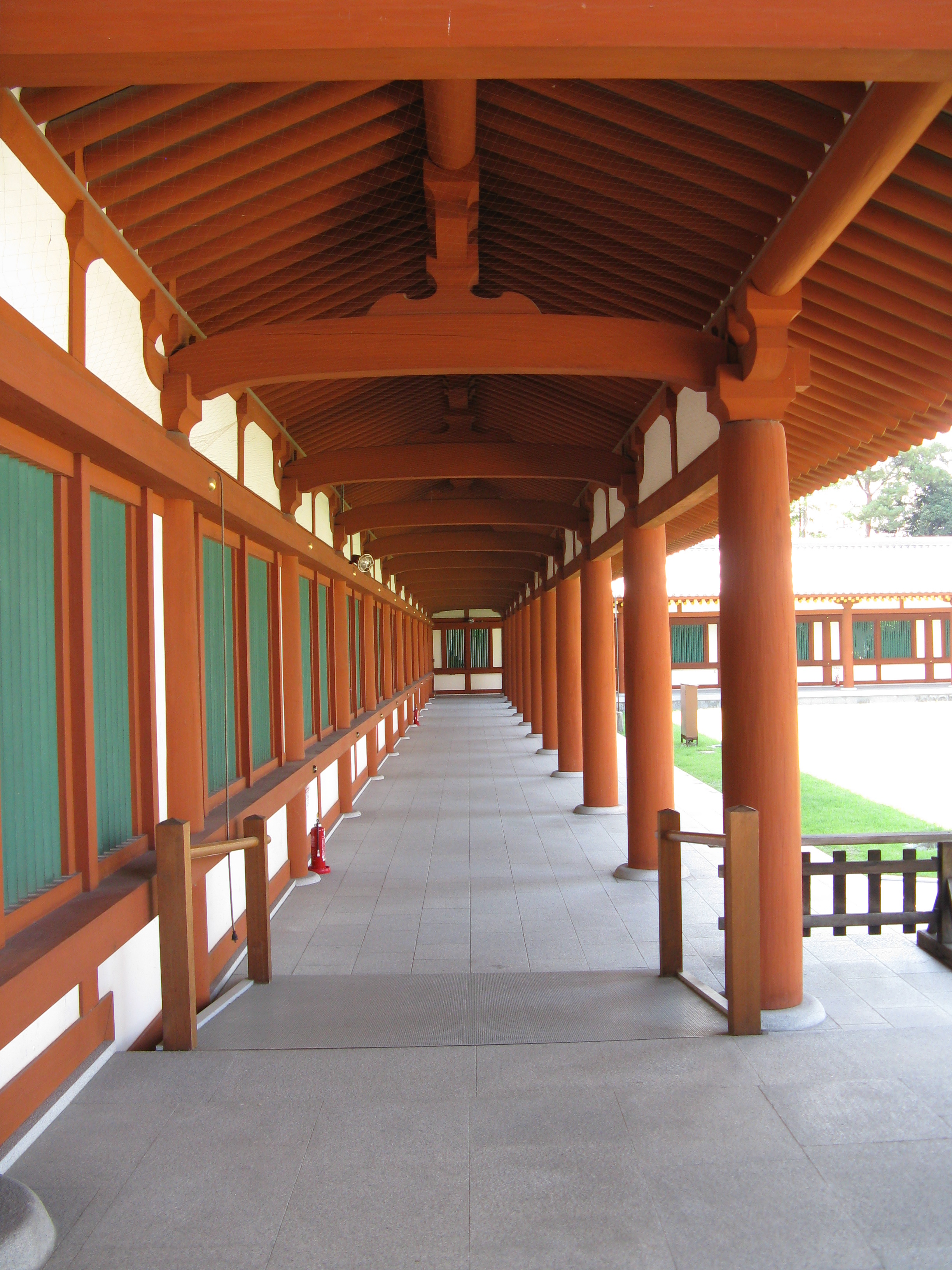
Two examples of ''kairō'' , , is the Japanese version of a cloister, a covered corridor originally built around the most sacred area of a Buddhist temples in Japan, Buddhist temple, a zone which contained the ''Main Hall (Japanese Buddhism), kondō'' and the ''tō''. Nowadays it can be found also at Shinto shrines and at ''shinden-zukuri'' aristocratic residences. The ''kairō'' and the ''rōmon'' were among the most important among the ''garan'' elements which appeared during the Heian period. The first surrounded the holiest part of the ''garan'', while the second was its main exit. Neither was originally characteristic of Shinto shrines, but in time they often came to replace the traditional shrine surrounding fence called ''tamagaki''. The earliest example of a ''kairō''/''rōmon'' complex can be found at Iwashimizu Hachiman-gū, a shrine now but a former .On the subject of shrine-temple complexes, see the article ''Shinbutsu shūgō''. The ''rōmon'' is believed to ha ... [...More Info...] [...Related Items...] OR: [Wikipedia] [Google] [Baidu] |
Archaeological Excavation
In archaeology, excavation is the exposure, processing and recording of archaeological remains. An excavation site or "dig" is the area being studied. These locations range from one to several areas at a time during a project and can be conducted over a few weeks to several years. Excavation involves the recovery of several types of data from a site. This data includes Artifact (archaeology), artifacts (portable objects made or modified by humans), Feature (archaeology), features (non-portable modifications to the site itself such as post molds, burials, and hearths), Ecofact, ecofacts (evidence of human activity through organic remains such as animal bones, pollen, or charcoal), and archaeological context (relationships among the other types of data).Kelly&Thomas (2011). ''Archaeology: down to earth'' (4th ed.). Belmont, Calif.: Wadsworth, Cengage Learning. Before excavating, the presence or absence of archaeological remains can often be suggested by, non-intrusive remote se ... [...More Info...] [...Related Items...] OR: [Wikipedia] [Google] [Baidu] |
Japan
Japan is an island country in East Asia. Located in the Pacific Ocean off the northeast coast of the Asia, Asian mainland, it is bordered on the west by the Sea of Japan and extends from the Sea of Okhotsk in the north to the East China Sea in the south. The Japanese archipelago consists of four major islands—Hokkaido, Honshu, Shikoku, and Kyushu—and List of islands of Japan, thousands of smaller islands, covering . Japan has a population of over 123 million as of 2025, making it the List of countries and dependencies by population, eleventh-most populous country. The capital of Japan and List of cities in Japan, its largest city is Tokyo; the Greater Tokyo Area is the List of largest cities, largest metropolitan area in the world, with more than 37 million inhabitants as of 2024. Japan is divided into 47 Prefectures of Japan, administrative prefectures and List of regions of Japan, eight traditional regions. About three-quarters of Geography of Japan, the countr ... [...More Info...] [...Related Items...] OR: [Wikipedia] [Google] [Baidu] |


